AuroraGeo Geoscientists & Data Engineers
Data-Driven Geoscience Services for Mining, Geohazards and Exploration
AuroraGeo Geoscientists & Data Engineers
Data-Driven Geoscience Services for Mining, Geohazards and Exploration

In the era of Big Data, it is easier than ever, to collect data from different sources in a small amount of time.
Strangely enough, it requires a lot of time to reach clear decisions which are based on reliable answers.
Our vision is to provide a coherent workflow to our clients for the mitigation of geohazards by fulfiling three inelastic conditions at the same time:
1) Safety of people and equipment;
2) Sustainable continuation of operation/production;
3) Best possible budget allocation and planning.

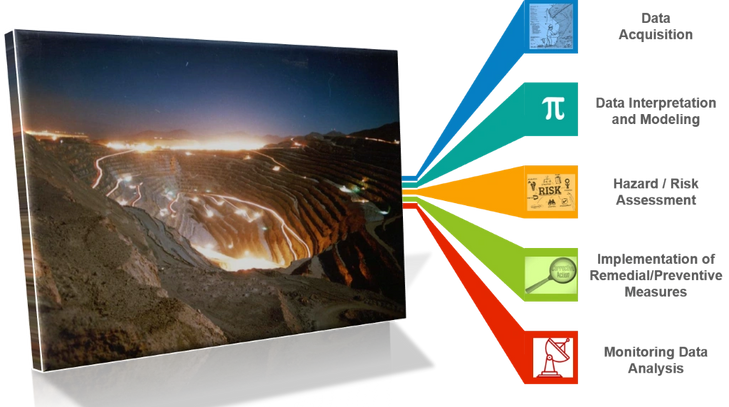
To provide a holistic approach to the Management of Geohazards covering the whole spectrum of this field:
1) Identification of Geohazard - Geoindicators and Type of Monitoring;
2) Understanding the Mechanism of Geohazard Initiation;
3) Data Collection and Processing;
4) Compilation of Geodatabases - Data analysis and Interpretation;
5) Compilation of the Suitable Model;
6) Risk Assessment by using Numerical Models of different types;
7) Managing the Geohazard in Short, Medium and Long Term;
8) Follow Up By Implementing the right Monitoring Strategy.
.png/:/rs=w:1200,h:1600,cg:true,m/cr=w:1200,h:1600)
We are confident that the key to providing services of high quality is to have a multidisciplinary approach to the Management of Geohazards.
Thus we have established collaboration with professionals that can cover the field of Geohazards in Civil and Mining.
We are acquiring data by using a broad range of techniques and instruments like:
a) Drones;
b) Lidars;
c) 3D Photogrammetric Techniques;
Nevertheless, the usage of conventional fieldwork techniques is in the centre of our data acquisition methods. They are fundament to deliver results of high quality.

To interpret the acquired data and to model the geo-environment, we are using methods and tools, that can provide reliable results which are trustworthy and most importantly, easily updatable.
Advanced GIS methods and Implicit Modelling are the core of our approach
For AuroraGeo, the added value is related a lot on the easiness that the outcome of the modelling process can be updated by the final user in a short amount of time.
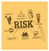
Assessment of the area of interest against various types of geohazards.
The evaluation can be done either in 2D or 3D depending on the working scale and the type of geohazard.
Definition of the state of instability with the use of deterministic and probabilistic analysis.
Sensitivity analysis can also be carried out to define more accurately the effect of each event controlling parameter to the phenomenon.
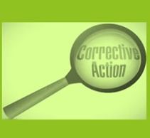
Design and dimensioning of the preventive or remedial stabilisation measures.
Supervision on the implementation of the stabilisation measures.
QA/QC procedures will ensure that the remedial and or preventive measures will be implemented according to plan.
AuroraGeo has the privilege to cooperate with IDS Georadar GRD, part of Hexagon Geosystems, by being the representative of IDS in Greece.
Our mission is to promote the products and services of IDS Georadar in the mining industry.
In addition, we are providing services related to Setting up the Right Monitoring Strategy, Interpretation of Monitoring Data and supporting our clients in compiling Triggered Action Response Plans (TARPS)

As consultants of IDS Georadar we are supporting potential or actual clients of IDS globally by providing the following services:
a) On-site training on the products of IDS;
b) Remote training,
c) Generation of weekly and monthly monitoring reports;
d) On-site monitoring and geotechnical audit.


